
“Landscape plotted and pieced – fold, fallow and plough”
Gerald Manley Hopkins
I like the idea that in the fields around us there are secrets waiting to be discovered; there are stories waiting to be told. That is the basis for this series of articles. This first one paints a more general picture of our local fields and then in the coming months I will share with you some of the secrets and stories that have been uncovered in YACWAG’s fields.
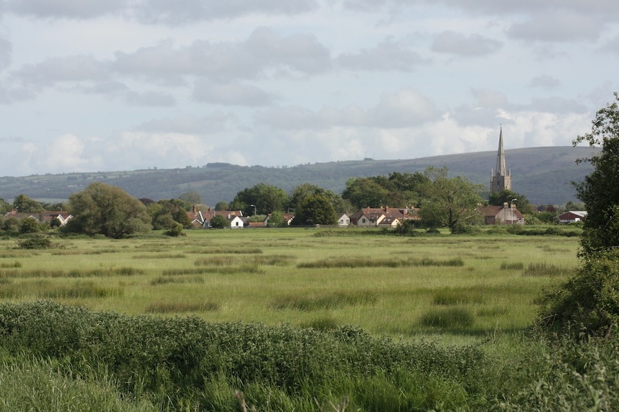
There is nothing that defines the English landscape more than fields. The word itself comes from the verb “to fell”, giving a clue to the origin of these parcels of land. Fields mainly came about as clearings in the wild woods that once covered Britain. For most of YACWAG’s fields their history is more recent than that but they still hold secrets to be revealed.
What We Have Lost
It is only in the last 70 years or so that fields have lost so much of the wildlife and cultural associations that they formerly had. Fields used to be the place where recreation took place, from archery practice to dancing. On old village maps you can often find ‘The Butts’ as a field name, which is what they called the area they all set aside for target practice. Fields were where people collected hedgerow fruit and nuts, firewood, herbs and other raw materials for daily life, couples did their courting and children played. Now fields mainly just provide food for sale, not for free. They are largely unvisited by urban populations. We are losing our connection with fields. I remember organising a walk on local public footpaths some 20 years ago and was astonished when an excited participant told me she had bought a pair of walking boots for the occasion. “I’ve never walked in a field before,” she said.
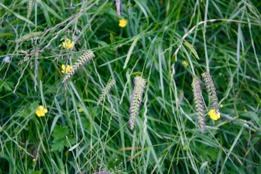
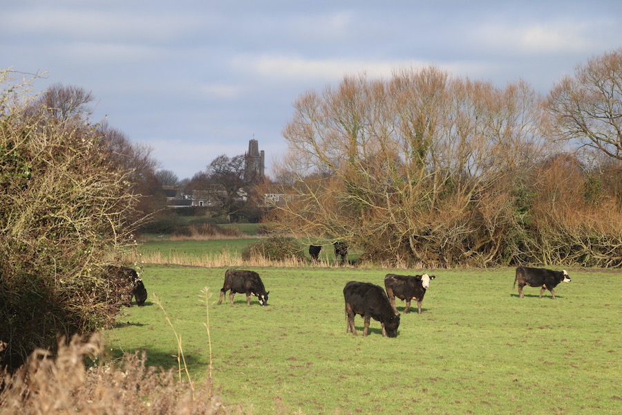
I have seen traditions like blackberrying and mushroom gathering almost disappear – although recent TV survival and bushcraft programmes have caused a small revival in gathering wild food. Artificial fertilisers and weedkillers have greatly reduced both mushrooms and wildflowers that used to grow in the fields. Frequent mowing for silage removes cover for small mammals and ground-nesting birds. It keeps the fields looking ‘tidy’ like the lawns of a stately home, but where are the skylarks, the hares and the barn owls? The tractor flail has largely dealt with brambles – and the tall hedges they grew in. We have also mainly lost the important winter food of grass and weed seeds which used to sustain a much larger bird population. The rhynes, ditches, hedges and walls that enclose fields are often the only wildlife habitat left, and form vital corridors enabling wildlife to move about an increasingly sterile landscape. In Yatton and Congresbury our local countryside is managed with less intensity but most of our fields are still not bursting with wildlife. We are lucky to have cattle grazing in our local fields. In many areas livestock is kept indoors and the fields just mown to feed them.
We might think because there is now little arable farming in Yatton and Congresbury, that it was ever thus. However, this is not the case. The Roman villa at Wemberham, in a field to the west of Yatton, was the house of a wealthy man who is believed to have overseen many local farms at a time when the climate was warmer and the land drier – partly thanks to Roman drainage works. A Roman corn-drying kiln has been found on Kenn Moor, on a wet site now considered marginal for corn, and the 2000 discovery of a Roman occupation site next to Gangwall suggests that the land here was not always so wet. Even as recently as the Second World War, local farmers were encouraged to dig for victory – or plough for victory – on fields which later were reverted to permanent pasture. Some of YACWAG’s fields on Congresbury Moor grew crops during the war and we found an ox shoe in one. Oxen were still being used for ploughing and haulage even up to the 1950s.
Long ago every community was more self-sufficient and each had a mixture of arable, hay meadow, woodland and pasture. The pasture for the peasant farmers was often held in common by the community. Locally there were open marshy moors on all sides of our villages before the Enclosure Acts in the early 19th century. The land was drained, straight drainage channels were made and fields were created which ended up in the hands of the wealthier landowners. YACWAG now owns four of these rectangular fields on Congresbury Moor, part of Biddle Street SSSI, with rare plants and invertebrates finding refuge in the ditches that were dug then.
Remembering Our Connections
We are seeing a lot of new ‘greenfield’ development in our villages. This has been going on since the 1940s, although the scale and pace of change is very different in recent times. My own house was the first built in Yatton after the War, in 1946. Building materials were scarce so we have a steel girder across our living rooms to hold up the too-narrow floor joists the builders had to use. Our internal block walls were made with ash and cinders, our window sills were quarry tiles. Court Avenue was built on land belonging to Court Farm, a former pigs’ paddock according to our deeds, and 45 years ago we even dug up a bit of a plough in the garden to prove it. When we let our front verge grow long for No-Mow May in 2020 we found Crested Dogs’ Tail as one of the grasses – a perennial indicator of old meadows and grassland.
Everywhere you look fields are remembered in our urban areas. In Yatton, Elboro was a large field; Hangstones was a field designated last century for the community as a ‘playing field’. It had obviously become agricultural land over time, although the shape of its boundaries suggest an earlier use than that, perhaps an Iron Age settlement. Many of our new housing estates are built within old field boundaries which can be traced on the ground by their remnant hedges. House builders link the present with the agricultural past in names like Meadowlands, Bramley Close and Briar Mead, while other names recall the farms on whose land they were built, like Cadbury Farm Road and Barberry Farm Road. Congresbury street names include The Lyes, Gooseham Mead and Bridge Farm Square.
In my next blogs, moving on from what we have lost, I am going to write about YACWAG’s fields and what we have found. Each field holds secrets which we are coaxing from the ground. Each field has a unique story.


